


This gauge house is one of the two gauge houses on Wieringen. The other is on the Quarantineweg on Westerland. Both gauge houses date from 1919. They were built on behalf of Rijkswaterstaat and were used to record the water level. There were more along the coast. The gauge houses on the former island of Wieringen were built before the construction of the Korte Afsluitdijk in the direction of Van Ewijcksluis and the large Afsluitdijk in the direction of Friesland. This made it clear what the influence of the arrival of these dykes was on the water levels. After the Second World War, the computer took over the measurement work and the houses became redundant. Valuation The gauge house is of cultural and architectural-historical value. It is a well-preserved example of the gauge houses from the first quarter of the 20th century that were built by the Dutch government. It is an element in the history of water management in the Netherlands. Sources Historical Association Wieringen: www.historischwieringen.nl Monuments Register: www.monumentenregister.cultureelerfgoed.nl Wikipedia: www.wikipedia.nl


Peilschaalhuisje Den Oever


Nearby locations
-

Chaletpark De Wierde
The Wierde is great for you if you like that typical North Holland landscape. Wonderful polder landscape, numerous monumental farms, charming dike houses and narrow hiking and biking trails. It is a paradise for water sports enthusiasts. From the harbor of Den Oever are dozens of ports within reach. The Wierde chalet park is your ideal base in the middle of an unprecedented varied vacation area a very modern park, with modern infrastructure.
-

Michaëls church
Early 12th-century church of tuff with crypt. Organ built by Teschemacher in 1762. Changing exhibitions and concerts; tower climbing with a magnificent view over the Wadden Sea and Wieringen. In the Michaëls church in Oosterland are changing exhibitions which you can visit. In the church are paintings and in the crypt of the church you will find visual work.
-

Wieringer Aak WR4 ‘Zelden Pas’
Tussen 1850 en 1900 groeide de vissersvloot enorm door toegenomen vraag uit de steden, verbeterde vervoersmogelijkheden van de vis en...
-

Basalt
-

De Wieringer Vloot
-
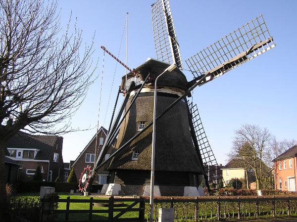
De Hoop
Corn mill De Hoop was probably built around 1654. Since 2015, the mill has been milling again and runs weekly thanks to the efforts of volunteers.
-

Wieringer Skuutje WR60
The Wieringer Skuutje WR60, built in 1840, is the oldest sailing fishing vessel in the Netherlands and owned by the Skuutje WR60 Foundation. The Skuutje is registered as a sailing monument in the Register of Sailing Heritage Netherlands (RVEN).
-

Vis van Havenzicht
At the foot of the Afsluitdijk in Den Oever, you can enjoy the tastiest fish at Vis van Havenzicht with the most expansive view of the fishing port and the Wadden Sea and the ships that pass between the Wadden Sea and the IJsselmeer. Mark and Michel know everything about fish through their years of experience as fishermen, which you will of course find in their range. Delicious baked, (home) smoked and ready-to-cook fresh fish, freshly cut herring, various freshly filled sandwiches, plate menus, fries, fish dishes (on order) and more.
-

discover ‘hidden’ Waddeneiland Wieringen
Walking route of Landscape North Holland. Wieringen is a "hidden" Wadden Island full of traces of the last ice age. Due to the closure of the Amsteldiep in 1924, the construction of the Afsluitdijk and the Wieringermeerpolder, Wieringen became part of the Noordkop. But it is still full of hidden stories, old villages, height differences, hollow roads, extensive meadows. Incidentally, the dog is allowed on a lead.